Have you ever noticed how maps of glaciers and their topography are stunningly beautiful? Probably due to the contrast between glacier (white or blue) and other (dark) colours the maps are uniquely visible and readable.
Here I present some of the tops mountain glacier map picks that I could find over the Internet, publications, books and map sheets – mostly vintage, old date. Unfortunately resolution some of the images could be low, however, it can’t prevent from a mesmerizing effect that pictures are producing.

Reinwarth (1973): Maps of Vernagtferner: 1969.

Haumann and Honegger (1964):White Glacier, Canada

Wright Glacier (1987)

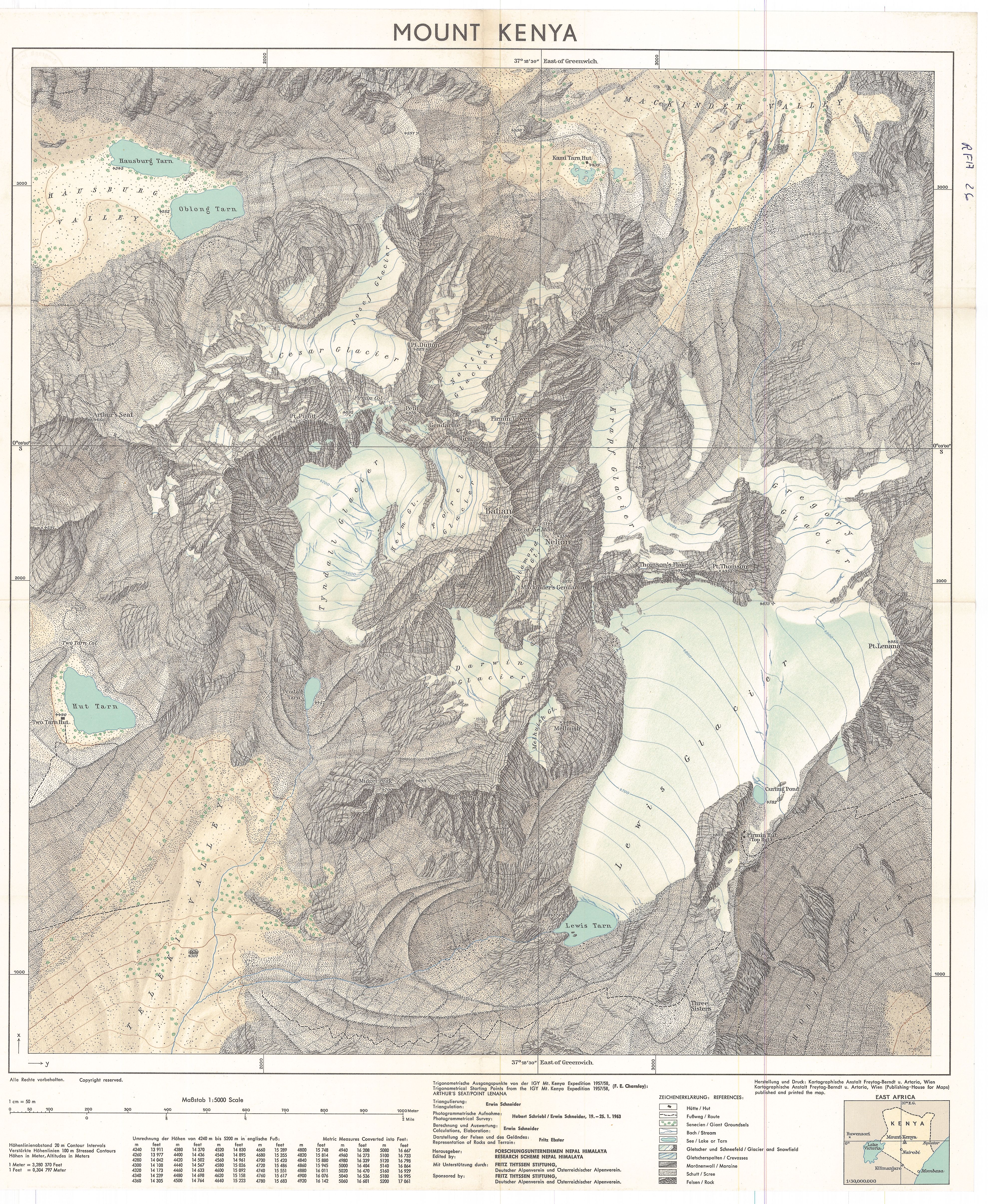
Schneider (1964). Lewis Glacier, Mount Kenya, 1963.

C. Perron. Mount St. Gothard (1885)

Synoptic map of the Rhône Glacier 1:25000

Map of the Glacier System Mount Rainier, Washington (1896)
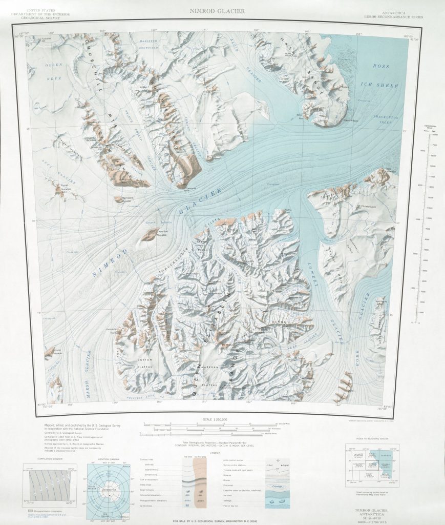
Nimrod Glacier 1:250,000 topographic map (USGS)
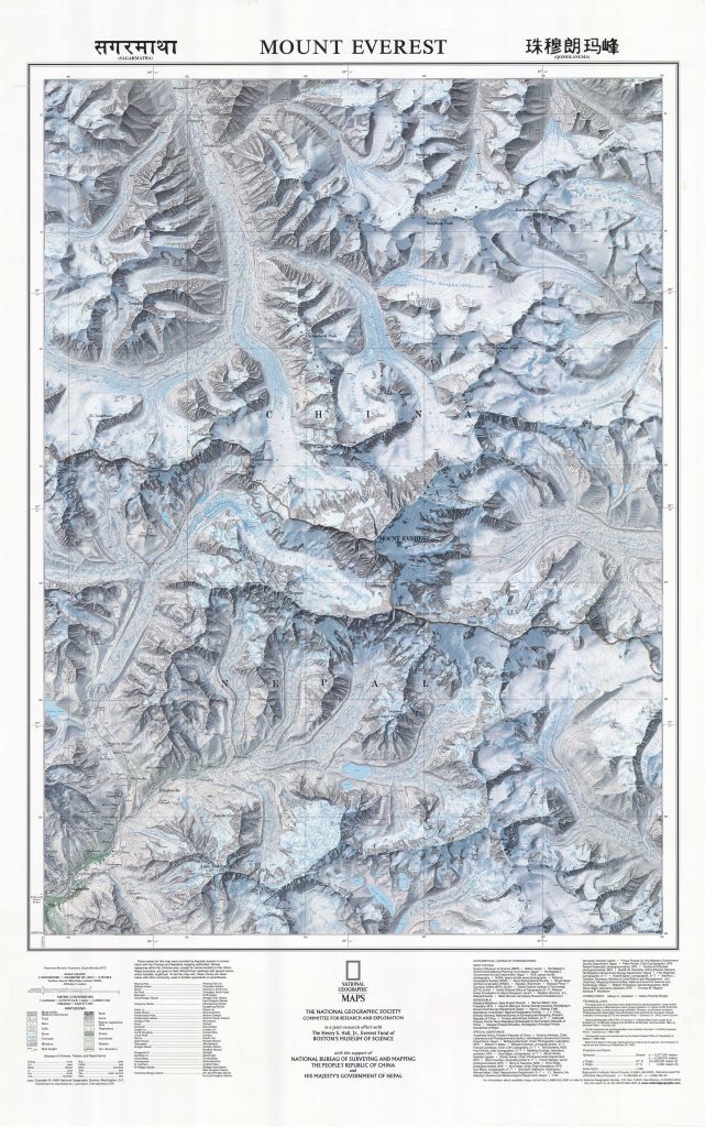
Washburn, Bradford. “Mapping Mount Everest.” Bulletin of the American Academy of Arts and Sciences, vol. 42, no. 7, 1989, pp. 29–44. JSTOR, JSTOR, www.jstor.org/stable/3824352.
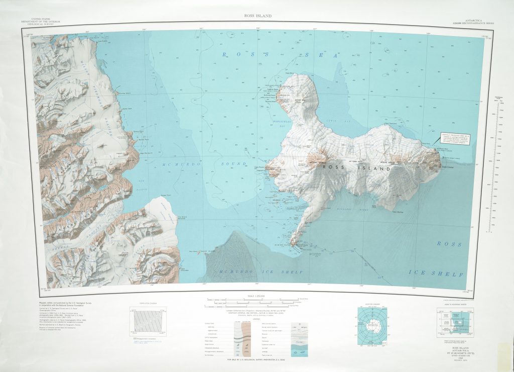
Ross Island 1:250,000 Topographic Reconnaissance Series (USGS)
Do you want to find out about spatial position of the Earth’s glaciers? Check out:
https://smartcarto.com/maps/interactive-world-glacier-map-database/ – Interactive World Glacier Map Database
Further reading and sources:
https://wgms.ch/products_fog_maps/ – Glacier Map Collection
https://www.swisstopo.admin.ch/en/knowledge-facts/cultural-heritage-year-2018.detail.news.html/swisstopo-internet/news2018/didyouknow/180416.html –
The map of the Rhône Glacier
https://www.nps.gov/parkhistory/online_books/geology/publications/pp/387-B/sec6.htm – Emmons Glacier
http://tamcamp.org/discover/maps – Transantarctic Mountain Science maps
http://maps.apps.pgc.umn.edu – The Polar Geospatial Center