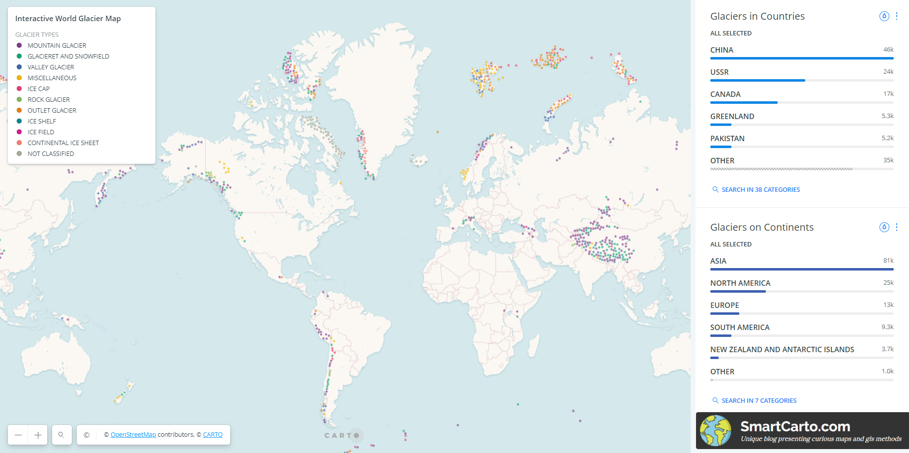
The World Glacier Inventory (WGI) contains information for over 130,000 glaciers. Inventory parameters include geographic location, area, length, orientation, elevation, and classification. The WGI is based primarily on aerial photographs and maps with most glaciers having one data entry only. The data set can be viewed as a snapshot of the glacier distribution in the second half of the twentieth century. It was founded on the original WGI from the World Glacier Monitoring Service.
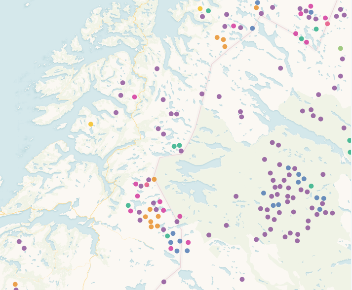
The Map is no longer available as Carto.com revoked my account. I have however a screen from it:
Acknowledgements
The National Snow & Ice Data Center continues to work with the World Glacier Monitoring Service to update the glacier inventory database.
Glacier Type Detailed Description
| Miscellaneous | Any type not listed below. |
| Continental Ice Sheet | Inundates areas of continental size. |
| Ice Field | Ice masses of the sheet or blanket type with a thickness that is insufficient to obscure the subsurface topography. |
| Ice Cap | Dome-shaped ice masses with radial flow. |
| Outlet Glacier | Drains an ice sheet, ice field, or ice cap, usually of valley glacier form; the catchment area may not be easily defined. |
| Valley Glacier | Flows down a valley; the catchment area is well defined. |
| Mountain Glacier | Cirque, niche type, crater type, or hanging glacier; also includes ice aprons and groups of small units. |
| Glacieret and Snowfield | Small ice masses of indefinite shape in hollows, river beds, or on protected slopes that have developed from snow drift, avalanches, and/or particularly heavy accumulation in certain years. Usually no marked flow pattern is visible; and it has been in existence for at least two consecutive years. |
| Ice Shelf | Floating ice sheet of considerable thickness attached to a coast nourished by a glacier or glaciers; snow accumulation on its surface or bottom freezing. |
| Rock Glacier | Lava-stream-like debris mass containing ice in several possible forms and moving slowly downslope. |
Do you want to find out about marvellous glacier papers maps? Check out:
- https://smartcarto.com/cartography/glacier-maps-marvellousness/ – Glacier Maps Marvellousness – Top Picks
More information and sources:
- https://nsidc.org/data/g01130 – World Glacier Inventory
- https://www.kaggle.com/nsidcorg/glacier-inventory – used dataset on Kaggle website
- http://www.carto.com – used Carto Builder in creating interactive map