In the age of digital cartography, where convenience and precision steer the helm, SmartCarto.com has introduced an innovative project that is revolutionizing the way we interact with maps and geographic information systems (GIS). ProximityMapp, the latest project of SmartCarto.com, stands out as an interactive map website designed to enhance the user experience by showcasing the nearest 20 points of interest (POIs) with just a few clicks. In this article, we will delve into the capabilities of ProximityMapp and explore how it can serve as an indispensable tool for various needs.
Precision at Your Fingertips
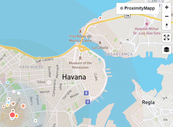
ProximityMapp is not just a map; it’s a versatile platform that amalgamates GIS technology with user-centric design. The website allows users to either search for a specific location, use the geolocation feature to pinpoint their current position or just click to select starting point on a world map. This seamless integration of functionality is tailored to provide an intuitive experience for users of all technical backgrounds.
Customizable Discovery
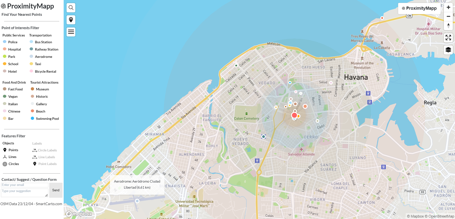
The sidebar of ProximityMapp is a gateway to personalized discovery. It hosts a variety of filters for public services, transportation, food and drink, tourist attractions, and more. Users can tailor the map to display POIs such as hotels, schools, parks, or even vegan restaurants and historical sites. The customizability ensures that whether you are a tourist in a new city or a local looking for new experiences, ProximityMapp has you covered.
Interactive and Informative
What sets ProximityMapp apart is its interactive nature. As users navigate the map, hovering over points instantly reveals the name of the place and its distance from the selected location, measured in kilometers. This feature not only provides immediate information but also allows users to gauge the proximity of various services and attractions effortlessly.
A Tool for Everyone
ProximityMapp serves a broad audience. For the individual user, it’s a way to explore their surroundings, find the nearest amenities, or plan a day out. For businesses, it presents an opportunity to identify the location of competitors, understand market saturation, and even find potential sites for expansion based on the geographic distribution of POIs.
GIS Enthusiasts and Cartographers
For enthusiasts and professionals in GIS, cartography, and geology, ProximityMapp is a showcase of smart GIS methods. It’s a platform where the complexity of geographic data is transformed into simple, actionable insights. The ability to filter map objects such as points, lines, circles, or labels adds an additional layer of interaction for those who appreciate the finer details of map-making and spatial analysis.
Technologies Powering ProximityMapp
- OpenStreetMap (OSM) Data Integration ProximityMapp’s accurate and detailed POI information stems from its use of OpenStreetMap, the most expansive and freely accessible world map dataset available. OSM’s dynamic and community-driven data provides the backbone for the detailed and rich geographic information presented on ProximityMapp.
- FME for Seamless Data Handling The integration of data into ProximityMapp is made possible by FME, the Feature Manipulation Engine. This robust tool is critical for the extraction, transformation, and loading (ETL) of geographic data from OSM into ProximityMapp’s framework, ensuring data remains current and accurate.
- PostgreSQL and PostGIS for Data Storage and Querying The heart of ProximityMapp’s data storage system is PostgreSQL, an advanced open-source database management system. Enhanced by the spatial database extender PostGIS, it provides comprehensive support for geographic objects, allowing ProximityMapp to efficiently manage spatial data and perform complex geographic queries.
- Mapbox for Elegant Map Visualizations Mapbox technology brings ProximityMapp’s interface to life with its powerful and sleek map rendering capabilities. It allows for the creation of responsive, interactive map layers that not only look professional but also enhance the user experience by providing a seamless interaction model for map navigation and data visualization.
A Mapping Solution for the Modern Explorer Through the harmonious combination of these technologies, ProximityMapp emerges as a user-friendly yet technically sophisticated tool. It’s an invaluable asset for travelers, real estate agents, city planners, and anyone in need of geographic information that’s both easy to access and rich in detail.
Conclusion: A Step into the Future of Mapping
ProximityMapp by SmartCarto.com is more than just a tool; it is a step into the future of mapping and GIS applications. It encapsulates the essence of what SmartCarto.com stands for – presenting curious maps and innovative GIS methods in a user-friendly format. As you embark on your next geographic exploration, let ProximityMapp be your guide to the world’s countless points of interest, all within reach with just a click.
Visit ProximityMapp today to experience ProximityMapp and discover the world around you like never before.