

As technology continues to advance, geocoding or geoparsing has become an important tool for businesses, organizations, and individuals to understand and visualize location-based data. Geocoding is the process of converting an address or location description into latitude and longitude coordinates, which can be used to display the location on a map or perform spatial analysis. However, manually geocoding thousands or millions of data points can be a daunting and time-consuming task. This is where ChatGPT geocoding comes in.
Introduction to Geoparsing and ChatGPT
ChatGPT is a large language model trained by OpenAI that can extract location information from natural language text. By using the title and article content, ChatGPT can identify the most probable location mentioned and output it in a standardized format of place, city, and country in one line. This enables geoparsing or geocoding to be automated, making it faster and more accurate.
FME Software and Automating Geoparsing with ChatGPT
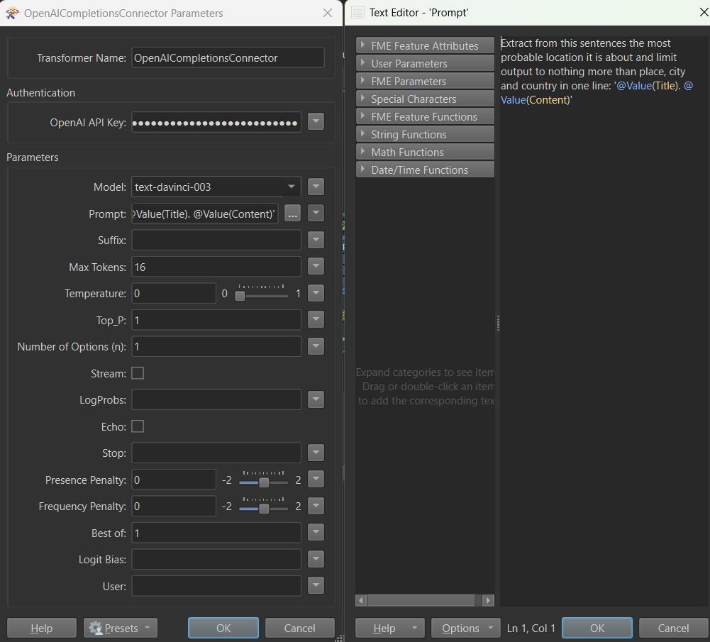
FME Software is a powerful tool for spatial data transformation and integration. It includes a wide range of transformers that can be used to manipulate data and automate workflows. One of these transformers is the OpenAICompletionsConnector, which can connect to the OpenAI API to access ChatGPT’s geoparsing capabilities. By using this custom transformer, FME users can easily incorporate ChatGPT geoparsing into their workflows.
How ChatGPT Geoparsing Works
To use geoparsing in FME, simply add the OpenAICompletionsConnector transformer to your workflow, specify the API key for your OpenAI account, and set the input and output fields. Then, use the “Extract from this sentence the most probable location” prompt to specify the text that should be geocoded. The output of the transformer will be the standardized location information.
Benefits of Automating Geocoding or Geoparsing with ChatGPT and FME Software
Using ChatGPT geoparsing with FME Software can significantly reduce the time and effort required for location-based data processing. With its powerful capabilities, it can help businesses and organizations make better decisions and gain insights from location-based data. Additionally, by automating the geoparsing process, errors and inconsistencies can be reduced, leading to more accurate and reliable results.
In conclusion, ChatGPT geoparsing is a valuable tool for extracting location information from natural language text. By using FME Software and the OpenAICompletionsConnector custom transformer, geoparsing can be automated, saving time and increasing accuracy. By leveraging the power of ChatGPT and FME, businesses and organizations can unlock the full potential of location-based data for improved decision-making and spatial analysis.