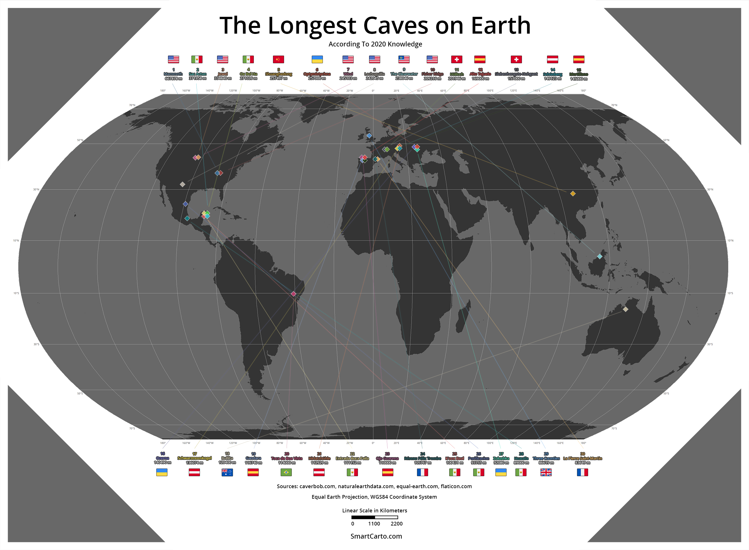
Did you see a map of the localization of the longest caves in the world? Me neither, that’s where the new idea was born to collect and try to visualize these magnificent natural creations. Nevertheless, it wasn’t easy.
Localization
The hardest part was to obtain the exact localization of the first thirty longest caves. Not every name is easily found with coordinates and searching for it through scientific articles is not a fast process.
During the searching process, I have discovered that some of the caves are not even listed in OpenStreetMap. Thus, I decided to repair such oversight and created some, new OSM features.
Methods and Software
The first phase of the work was to prepare a background map in ArcGIS. This included: adjusting the projection to Equal Earth, adding shapefiles from Natural Earth, choosing colors, making proper grids. I’ve manually geocoded also cave points (POIs) in ArcMap and tried to visualize them but it was strangely cutting the edges of it after exporting to PNG format.
After all, I’ve decided to switch mapping to Photoshop where I manually draw points and the rest of the graphics besides flags that were taken from Flat Icons.
Longest Caves on Earth in Table
| No. | Cave | Country | Length (metres) | OSM Entrance Location Coordinates (lat, lon link) | Action on OSM |
| 1 | Mammoth Cave System | United States | 667878 | 37,1875804, -86,1035650 | |
| 2 | Sistema Sac Actun | Mexico | 371958 | 20,3179170, 87,4096669 | |
| 3 | Jewel Cave | United States | 334840 | -34,2739715, 115,0980270 | |
| 4 | Sistema Ox Bel Ha | Mexico | 271026 | 20,1604361, -87,4876073 | |
| 5 | Shuanghedong | China | 257497 | 28.2420171, 107.2760840 | Changed to proper name |
| 6 | Optymistychna | Ukraine | 257000 | 48.7349443, 25.9737988 | |
| 7 | Wind Cave | United States | 245103 | 43.5580509, -103.4795485 | |
| 8 | Lechuguilla Cave | United States | 242045 | 32.1906420, -104.5033091 | |
| 9 | The Clearwater System | Malaysia | 238046 | 4.0652984, 114.8317560 | |
| 10 | Fisher Ridge Cave System | United States | 209216 | 37.2472, -86.643 (not exact) | |
| 11 | Hölloch | Switzerland | 201946 | 46.9769524, 8.7886955 | |
| 12 | Sistema del Alto Tejuelo | Spain | 169000 | 43.2583151, -3.6872664 | |
| 13 | Siebenhengste-Hohgant-Höhle | Switzerland | 157000 | 46.78382, 7.90123 (not exact) | |
| 14 | Schoenberg-Höhlensystem | Austria | 149123 | 47.9918344, 15.9733812 | |
| 15 | Sistema del Mortillano | Spain | 145000 | 43.243191, -3.76389 (not exact) | |
| 16 | Ozerna | Ukraine | 140490 | 48.7644458, 25.9659066 | |
| 17 | Schwarzmooskogel-Höhlensystem | Austria | 136074 | 47.69094, 13.82147 (not exact) | |
| 18 | Bullita Cave System | Australia | 120400 | -16.0633781, 130.3833142 (not exact) | Added potential cave entrance |
| 19 | Sistema del Gandara | Spain | 116740 | 43.1905576, -3.5863275 | |
| 20 | Toca da Boa Vista | Brazil | 114000 | -10.1625251, -40.8597012 (not exact) | Added potential cave entrance |
| 21 | Hirlatzhöhle – Schmelzwasserhohle | Austria | 112929 | 47.5449754, 13.6309534 | |
| 22 | Entrada Boca Paila | Mexico | 111152 | 20.0087761, -87.4908678 (not exact) | Added potential cave entrance |
| 23 | Systeme de Ojo Guarena | Spain | 110000 | 43.04722, -3.6204 (not exact) | |
| 24 | Reseau Felix Trombe / Henne Morte | France | 105767 | 42.9725465, 0.8664373 | |
| 25 | Sistema K’oox Baal – Sistema Tux Kupaxa | Mexico | 100431 | 20.356412, -87.400083 (not exact) | |
| 26 | Sistema Purificacion | Mexico | 93755 | 23.857454, -99.676742 (not exact) | |
| 27 | Zolushka | Ukraine / Moldova | 92080 | 48.2801152, 26.6335117 | |
| 28 | Sistema Huautla | Mexico | 89000 | 18.100976, -96.749775 (not exact) | |
| 29 | Three Counties System | United Kingdom | 86619 | 54.19749, -2.494618 (not exact) | |
| 30 | Gouffre de la Pierre Saint Martin | France / Spain | 83649 | 42.9679630, -0.7691232 |
Cave Comparison on Bar Diagram
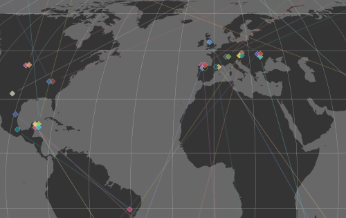
Cartographic Visualisation On a Map
Dataset to download
Download dataset as ESRI Shapefile (.shp)
This work is licensed under a Creative Commons Attribution 4.0 International License.Sources
- http://www.caverbob.com/wlong.htm – World Longest Caves Compiled by Bob Gulden – Jan. 22, 2020
- https://en.wikipedia.org/wiki/List_of_longest_caves
- https://www.naturalearthdata.com/ – Natural Earth Data
- https://www.statista.com/chart/17665/longest-caves-in-the-world/
- http://equal-earth.com/ – Equal Earth projection
- https://www.flaticon.com/packs/rectangular-country-simple-flags – Country Flags