
A month ago polish government shared a WMS service providing a link to GeoTIFF imagery file of the country. This is the “first stage of geodetic and cartographic data release”. I want to thank people from Globema company who created FME workspace for obtaining these files. Seeing one of their webinars and using this tool inspired me to enhance that solution.
I had thought about a couple of new features for downloading imagery files, and decided to improve developed workspace with such new ideas and functions:
1. Converting from EPSG:4326 (WGS84) to EPSG: 2180 (1992) – when someone will enter coordinates of the bounding box in “54.432423, 24.432423” format it will be converted to 1992 coordinate system.
2. Creating Bounding Box of the interest area from input coordinates (left down corner and right up corner) – this one is needed for point 3 and 5.
3. Downloading sheets of imagery from an official source Head Office of Geodesy and Cartography (this is actually a custom transformer). Relating these polygons with an interest area and creating coordinates from it for query – WMS query is pointing to the center of these polygons and responding with URLs to the GeoTIFF files.
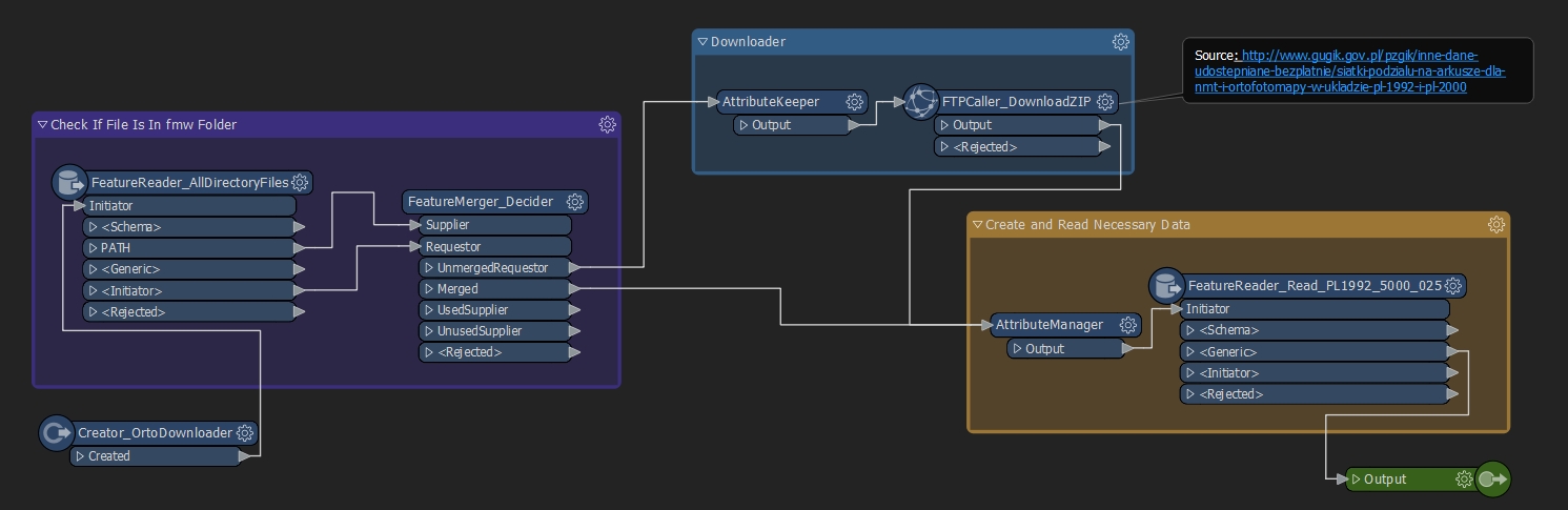
4. Filtering data only to RGB – this is only for my need, it can be adjusted to requirements.
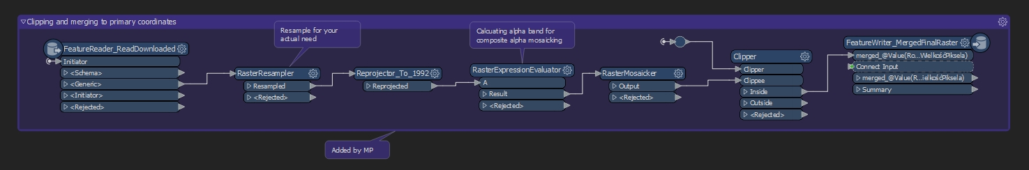
5. Resampling, merging (mosaicking) and clipping downloaded sheets by interest area – There was a tricky part because some of the imagery had no data values which produced unnecessary black polygons. To deal with it I have calculated the alpha band for each of those downloaded rasters and used it in mosaicker transformer.
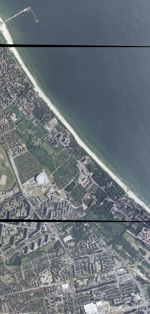
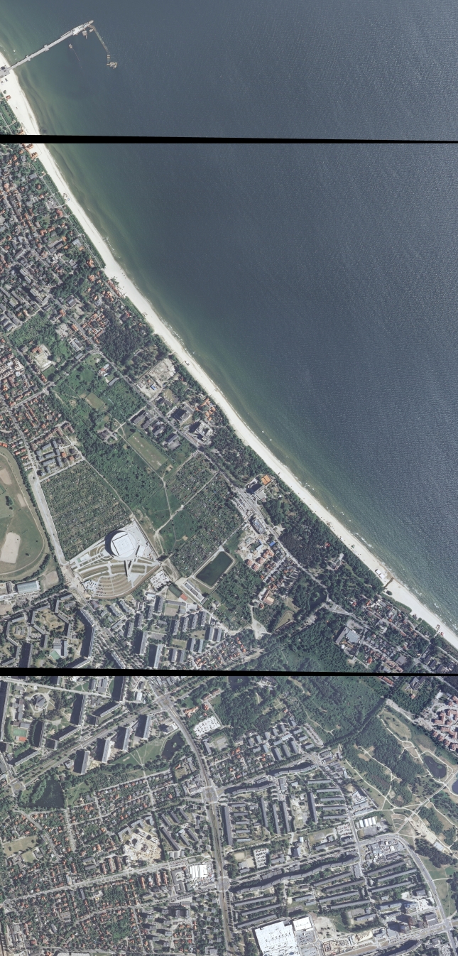
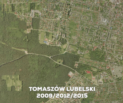
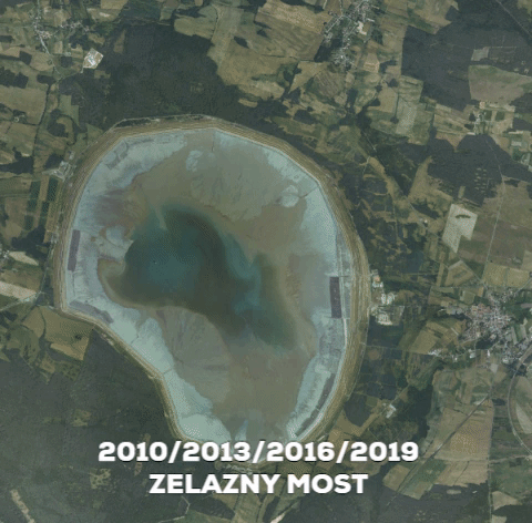
Imagery examples
I have tested it on a couple of regions and downloaded imagery from available years, quality is quite different, you can observe it below. The black borders around each sheet are a result of the data mosaicking tested without using specific merging method. I dealt with it by calculating fourth alpha band of the imagery files.
2010 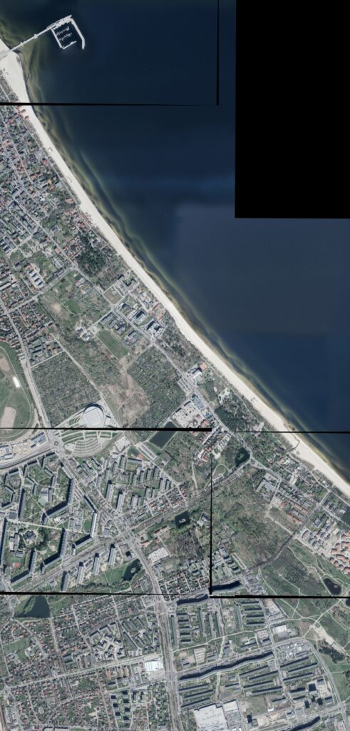
2013 
2016 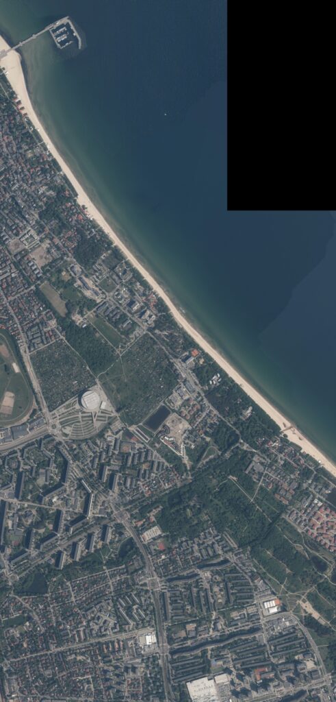
2019
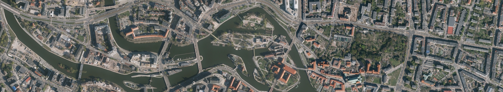
Wrocław (Poland) – 2019
Final thoughts are that this tool could be easily provided as a backend for a website where you download an interest area for Poland. By the way, I would like to thank Mateusz Pyra from Globema company for advice and getting this small project to see the daylight.
You can download .fmw (FME) project file below and try it for yourself!
Enhanced Orto Downloader
Subscribe and send download link to:
Links
- http://www.gugik.gov.pl/aktualnosci/24.06.2020-pierwszy-etap-uwolnienia-danych-rozpoczety
- https://fme.globema.pl/2020/07/08/fme-open-data-case-study/
- http://www.gugik.gov.pl/pzgik/inne-dane-udostepniane-bezplatnie/siatki-podzialu-na-arkusze-dla-nmt-i-ortofotomapy-w-ukladzie-pl-1992-i-pl-2000
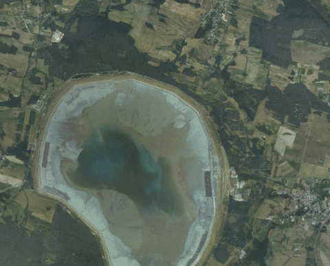
- https://en.wikipedia.org/wiki/Żelazny_Most_(lake)